The Menhir des Marsouins: The Stone That Stood in the Way of a Curse
August 1978: a shore black with oil, thousands of soldiers on cleanup duty — and a priest’s strange request that changed everything.
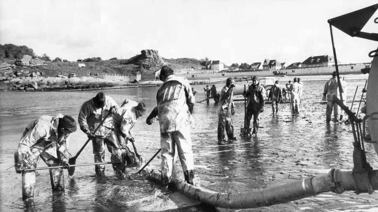
August 1978. Brittany. The shore is black with oil. Thousands of soldiers have been thrown into the cleanup. In the first two weeks alone, twelve thousand dead birds were collected here.
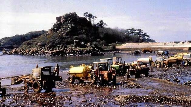
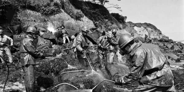
Brittany, 1978: cleaning the shore after the disaster.
And in the middle of all this, a local priest walks up to the soldiers with a strange request: help him raise an old stone that had lain on the cape for centuries.
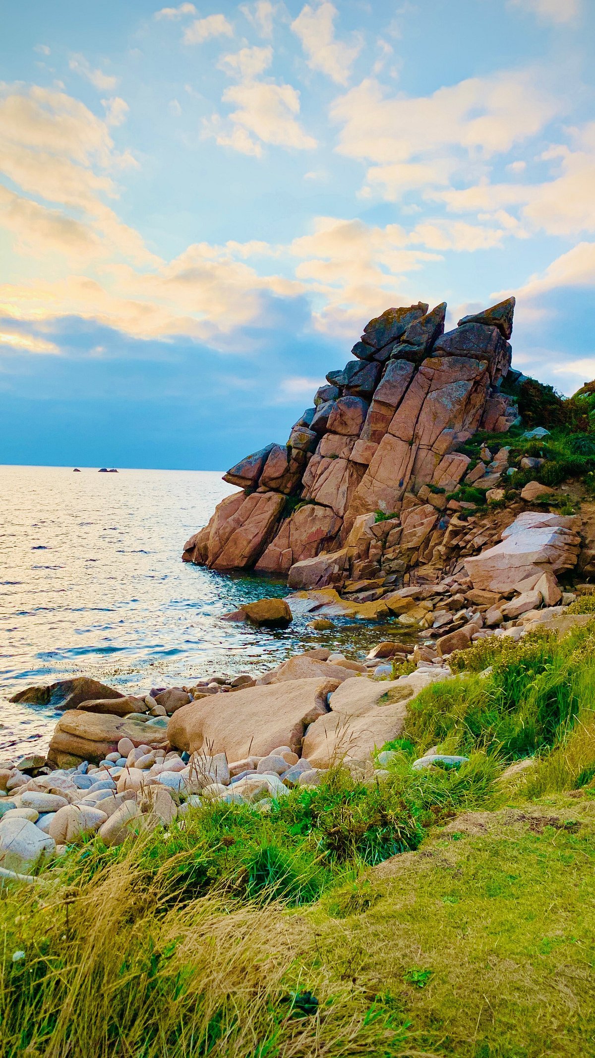
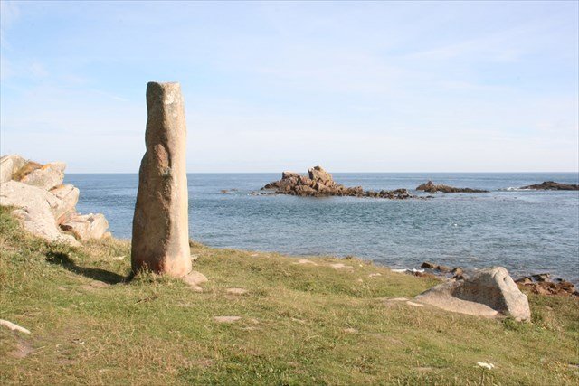
Cap Primel, on the northern coast of Brittany, has had a bad reputation for more than a century. It is a long granite tongue reaching out into the sea at the entrance to the Bay of Morlaix. A beautiful place — and a deadly one.
Cap Primel — a granite tongue reaching into the sea at the entrance to the Bay of Morlaix.
Back in the Middle Ages, a ship carrying a cargo of copper ingots met its end here. It lies at depth right at the foot of the cape, and almost nothing is known about it: not who built it, not where it was going, not what the crew was called. The dating is roughly the 11th–12th centuries. When scientists learned of the wreck in the 1970s, divers had already carried off the copper ingots before archaeologists could get there. One of the ingots, raised by a local resident in 1978 in the Bay of Diben, launched a full excavation forty-four years later — carried out by a DRASSM team from the vessel André-Malraux in 2021–2022.
Then come the dry figures that speak louder than any legends.
In just seven years, from 1888 to 1895, nine ships were lost off the cape. The count grew so bad that France took an extreme measure: a lifeboat station was opened here. Such stations were not built just anywhere — only where shipwrecks happened regularly. It was the country’s one hundred and second lifeboat station. The rescuers put to sea in the rowing lifeboat Docteur Comme — twelve oarsmen, under sail when needed; the boat was hauled to the water by hand on a cart, and they rowed to the sinking ship through the storm. The first launch took place on 27 December 1910, to the steamship Saint André.
On 18 November 1893, a storm burst into the bay that people would still be talking about half a century later. The three-masted clipper Aboukir-Bey — a Cape Horner built in Greenock in 1883, carrying a cargo of Chilean saltpetre — was lost at the entrance to the bay with her entire crew. Nineteen men. The bodies were scattered along the shores: three were found at Le Taureau, four at Plouezoc’h, twelve at Carantec. Fragments of the ship’s lifeboats kept washing up on the shores of Primel for decades. The clipper’s wreck lies at a depth of about twenty-five metres off Carantec, and today it is a popular dive site — there is even a 3D photogrammetry model.
The cape collected everyone. Vikings were seen here in the 9th–10th centuries. The English in the Hundred Years’ War. Spaniards and La Fontanelle’s bandits in the 1590s. A Vauban battery. A Napoleonic customs post. The rocks at Primel are not just scenery; they are a place where sea and land meet in a geometry that is very inconvenient for human beings.
But the cape took its biggest prize on 16 March 1978.
A Rudder, a Towline and Nine in the Evening
Ten in the morning, the channel off the island of Ushant, eight miles to the north. The supertanker Amoco Cadiz is sailing from the Persian Gulf to Rotterdam with a cargo of crude oil — 223,000 tonnes. The ship flies the Liberian flag, belongs to the American Standard Oil of Indiana, was built in Spain, and has an Italian crew. 334 metres long. One of the largest ships on the planet.
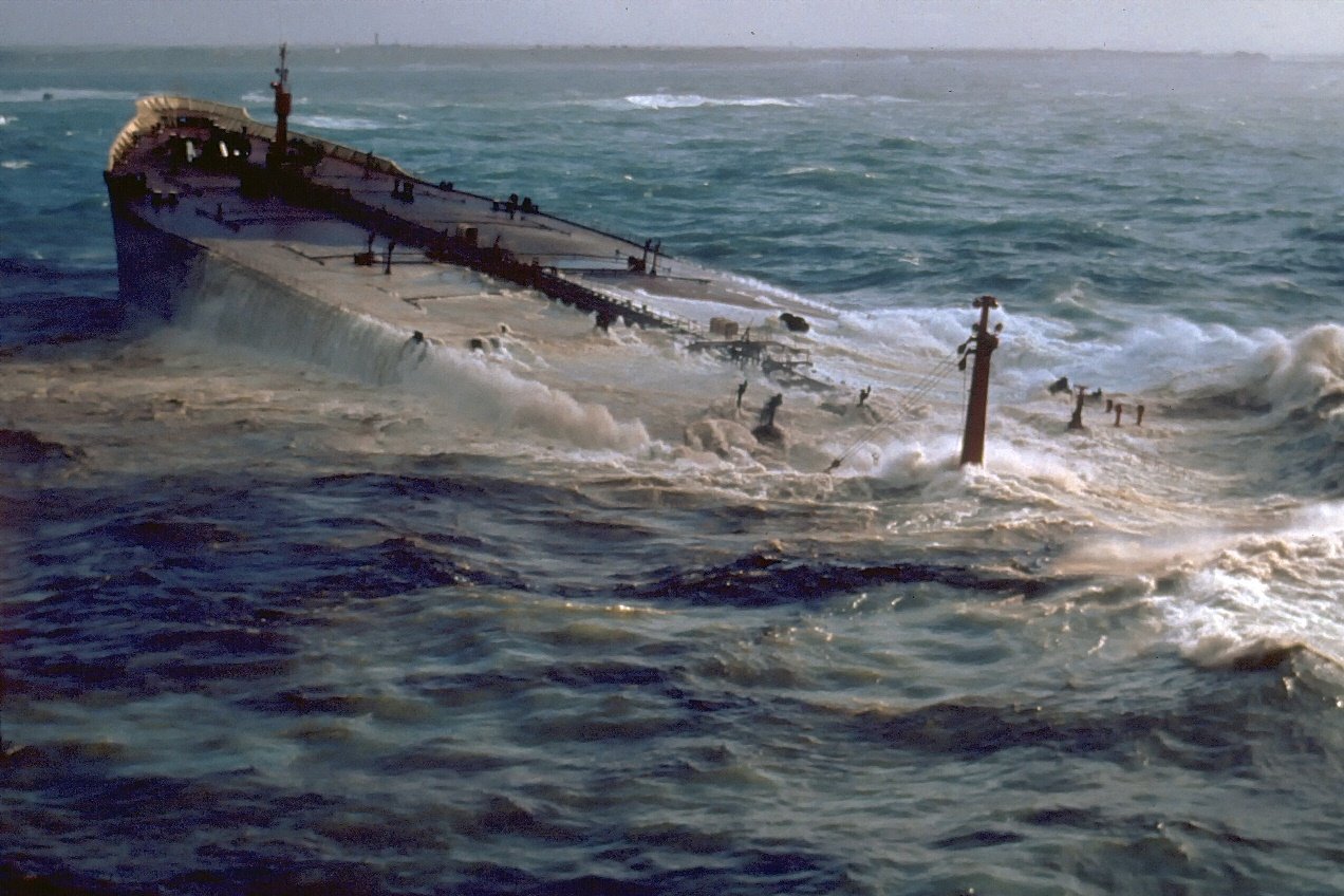
Amoco Cadiz on the Portsall rocks. March 1978.
And then the thing happens that court documents would later call “a disaster waiting to happen.”
A heavy wave slams into the rudder. In the hydraulic system, five of the six flange studs shear off. Hydraulic oil gushes out. The rudder — nearly 160 tonnes, thirteen metres tall — breaks free, begins to swing wildly and smashes the steering gear to pieces. A crew member is wounded by the fragments. There is no way to fix this with the crew’s own hands.
There was no backup system at all. No second rudder, no thrusters. A total hydraulic failure meant a total loss of control.
And this was no accident. Amoco had known about the problems for years. The cylinders had been scored back in the 1974 sea trials. The system was losing seven to twelve litres of hydraulic oil a day — against a norm of a few drops. The shut-off valves were painted solid. The oil was neither changed nor filtered.
Then came the hours that cost Brittany everything.
Captain Bardari stalled for nearly two hours before accepting help from the tug Pacific: they were haggling over the Lloyd's Open Form salvage contract while the tanker drifted towards the shore. Wind up to 130 km/h. Seven-to-eight-metre waves. The first towline — a chain — snapped at 16:16. The second attempt took almost four more hours.
At 21:04, Amoco Cadiz ran aground on the Portsall rocks, by the Men Goulven stone, 1,100 metres from the Corn-Carhai lighthouse. The hull was breached. The cargo began pouring into the sea.
It was oil.
It would become the largest “black tide” disaster in the history of the tanker fleet. The oil would spread along 360 kilometres of coastline — from Brest to Saint-Brieuc.
The Marsouins
The spring of 1978 in Brittany was black.
The oil killed about thirty-seven thousand birds. Of those caught in the slick, one in twenty survived. The ecosystem needed six to seven years to recover. The oyster farms lost 6,400 tonnes of oysters.
Fourteen thousand people cleaned the shore. Half of them were military.
Farmers joined the cleanup along with everyone else. They hauled fuel oil off the beaches in liquid-manure barrels — there was simply no other container in this rural area. About one hundred thousand tonnes of “chocolate mousse” and contaminated waste were collected; part of it was buried in the ground at a hundred sites in Côtes-d'Armor and Finistère. The cleanup on land went on for more than six months.
France threw fourteen thousand people at the disaster. Half of them were military. At the peak of the work, from 11 April to 7 May, up to 7,447 people and up to a thousand vehicles worked daily at ninety sites.
In France, marines are called “marsouins” — porpoises. The nickname is old, from the nineteenth century.
Remember that word. Marsouins.
Marsouins on the coastal cleanup. 1978.
They scraped the rocks with steam cleaners and loaded the stinking fuel oil into sacks. They worked in shifts and lived in a vacant holiday home on the beach. The 23rd Marine Infantry Regiment, the 23e RIMa, was mobilised twice — in early May and in August 1978. The company was commanded by Captain Bernard François.
And one evening, a curate came to the marines as they rested after a hard day.
His name was Abbé André Tanguy. Born on 4 January 1920 in Morlaix, he studied at the Quimper seminary, then theology in Le Mans. In 1978 he was fifty-eight. And he was not just a priest — he was an amateur archaeologist known to science. In the SRA Bretagne monograph on the prehistory of the Lanmeur canton he is mentioned as a discoverer: he had collected a prehistoric vase from a collapsed stone cist on Primel, described by Pierre-Roland Giot and Briard. This man had walked the cape for decades and knew every fold of its ground.
In other words, he did not “guess” the menhir. He knew what he was looking for.
“You have hands, pickaxes and a free evening. Will you help?”
Marsouins, as one of them later wrote, love a challenge.
They agreed.
The abbé led them to a strange long stone, half-buried under moss and grass.
A Bed Prepared Thousands of Years Ago
After their shifts, the marines dug and cleared the recumbent stone.
When they had cleared it along its whole length, they saw a roughly pointed base and a flat top. That is how stones are dressed when they are meant to stand upright.
They began to dig under the pointed base — and soon their shovels clinked against flat stone slabs. The slabs were laid in a triangle, and they lay at about forty centimetres deep. It looked like the bed of a menhir.
Now there was hardly any doubt left: the stone really was no ordinary one. Someone, thousands of years ago, had prepared a nest for it.
But the lads had no equipment to set a multi-tonne block upright.
The next day they came back with trestles, log levers and hand winches.
Lift — prop — pull — lift again.
And at last the stone stood. It slid down and settled into the bed so precisely and firmly that, in the words of the squad leader, “there was no doubt it had stood here for centuries.”
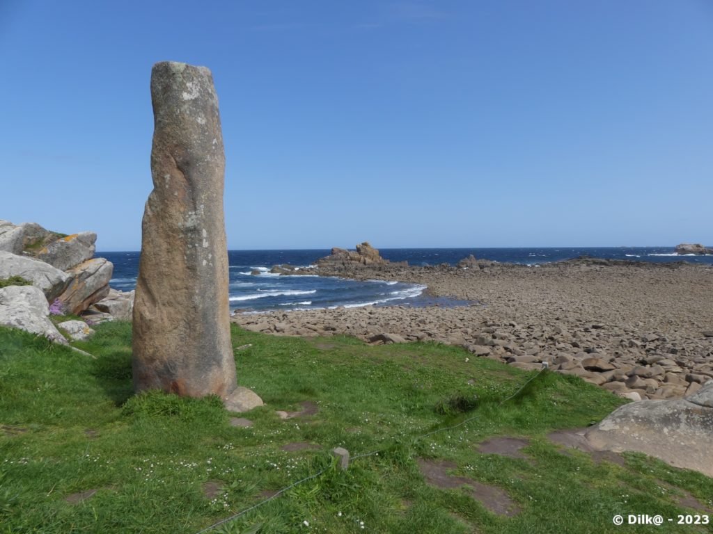
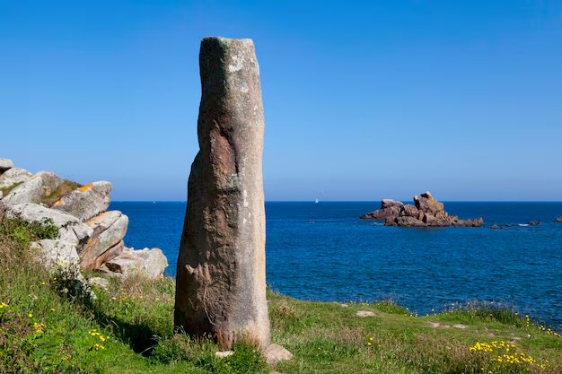
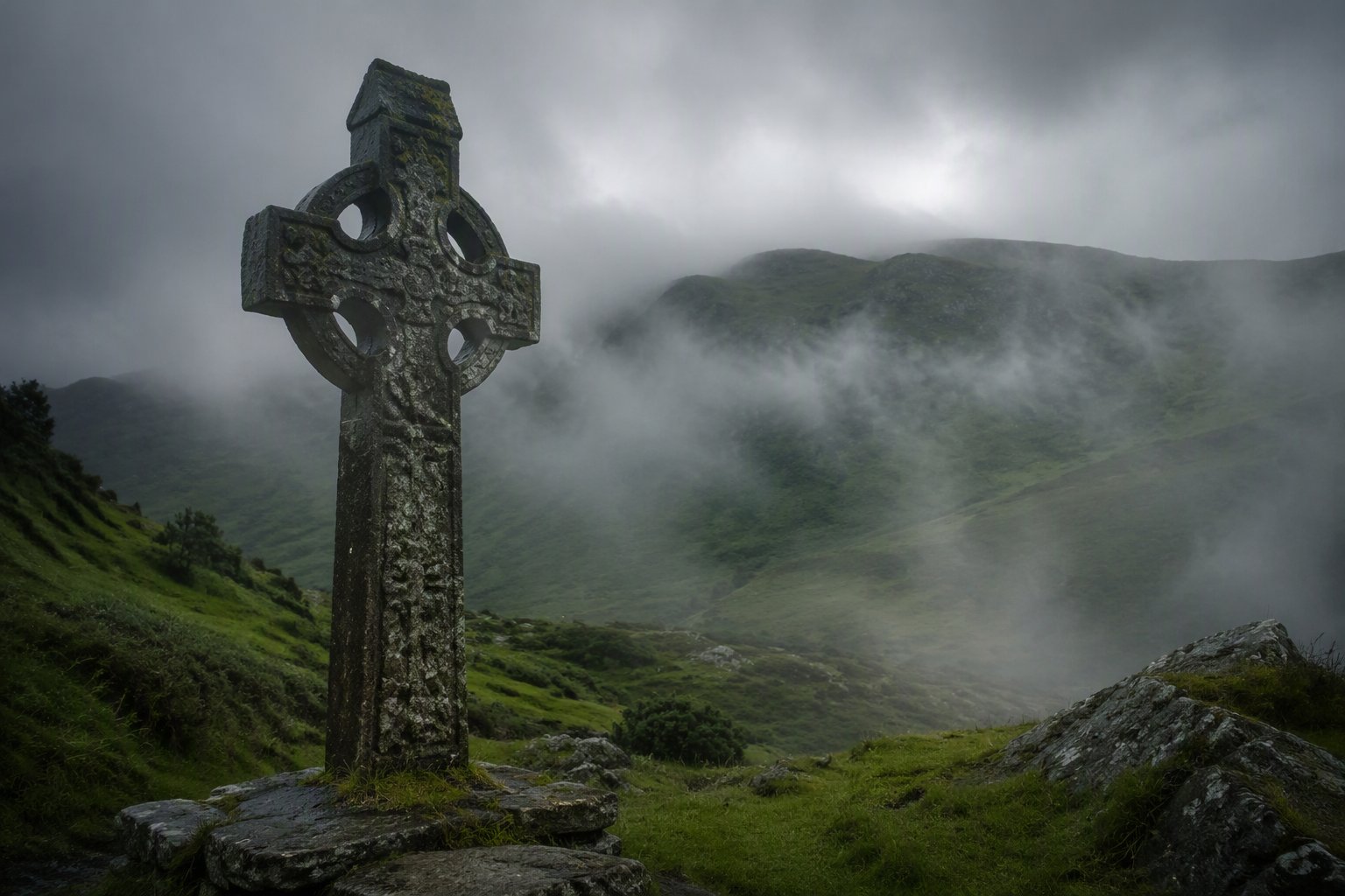
The Menhir des Marsouins. Height — about three metres.
Menhirs are ancient sacred stones that held sacral meaning. They were set upright as an axis between earth and sky, a symbol of the joining of worlds. People came to these stones for help and protection. And they paid them, leaving something personal in exchange for patronage. In Breton folklore this is clearly visible: on the island of Sein, fever patients laid out nine pebbles in a handkerchief at the foot of the menhirs — it was believed that whoever took them took the illness too. The girls of Carnac rubbed against “their” menhir at night, asking for a husband. At Saint-Just you had to walk around the stone three times before sunrise — for a year of luck. The Church fought this for centuries: the menhir of Saint-Uzec was literally “baptised” in 1674 — a cross was placed on top and the Passion was carved on its face.
No direct ritual of “a menhir protects against shipwrecks” exists in the sources. Only the general practice is documented: people asked the stones for help and patronage, leaving something personal in exchange.
This stone — about three metres tall — was named after the marines who raised it. Menhir des Marsouins. The Menhir of the Marsouins. In English, the name translates as the Porpoises Menhir.
Not a Single Ship
And from that very August of seventy-eight, when the stone rose, not a single ship has been lost off this cape.
The logbook of the SNSM station at Primel-Plougasnou is still full. A yacht run aground. A boat towed in. A lost kitesurfer. The routine of the rescue service. But the cape that had collected ships for nine hundred years stopped doing it.
A coincidence?
Of course, a coincidence.
But perhaps this coincidence has an address, a date and a name: the Menhir des Marsouins.
The stone stands. And the cape is silent.
Epilogue
The oil was washed off the shore within six months. The sea healed its wounds.
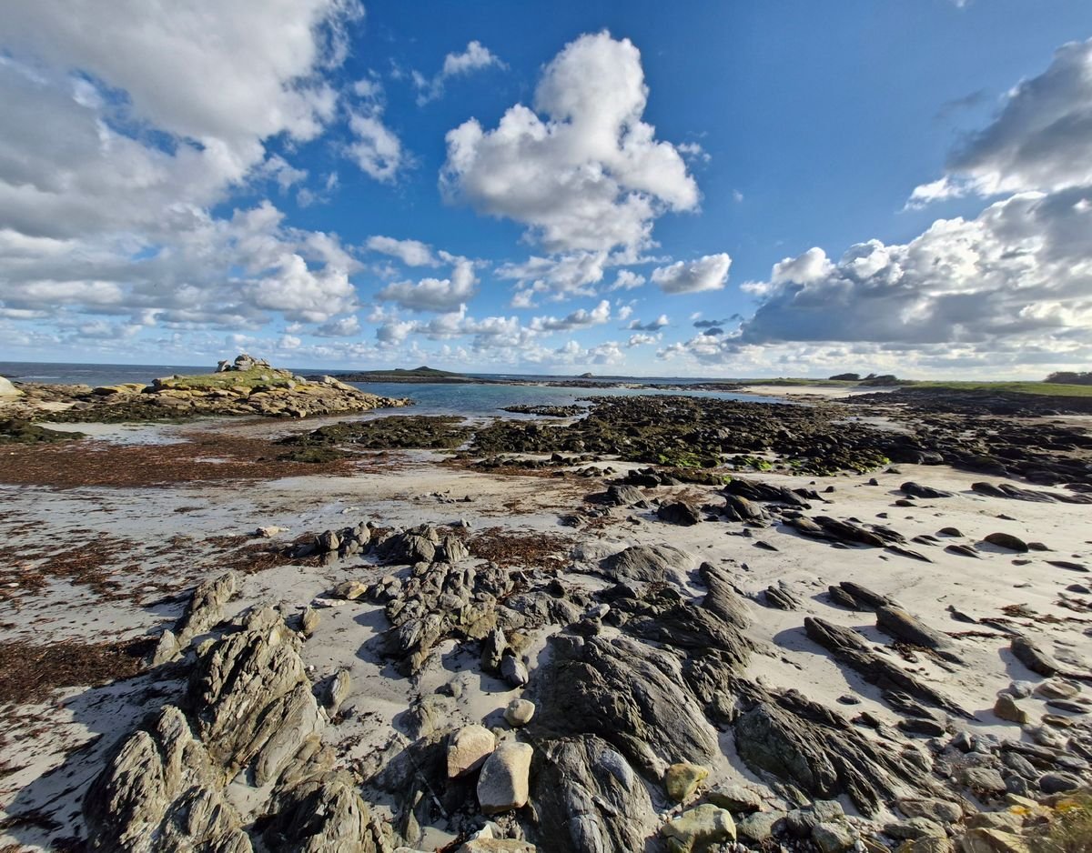
The coast at Primel today.
But Brittany has a curse that cannot be washed away with water or scraped off with a shovel. It is not on the beaches and not in the rocky shores. It is in the blood.
One in eight Bretons carries it without suspecting a thing. Doctors have various names for it, but the locals call it the Celtic curse.